2/17/06
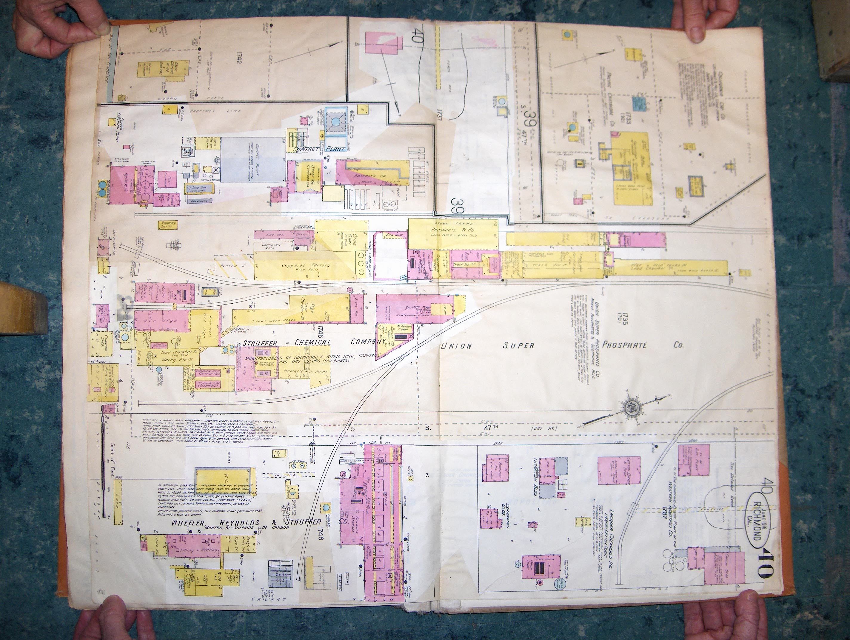
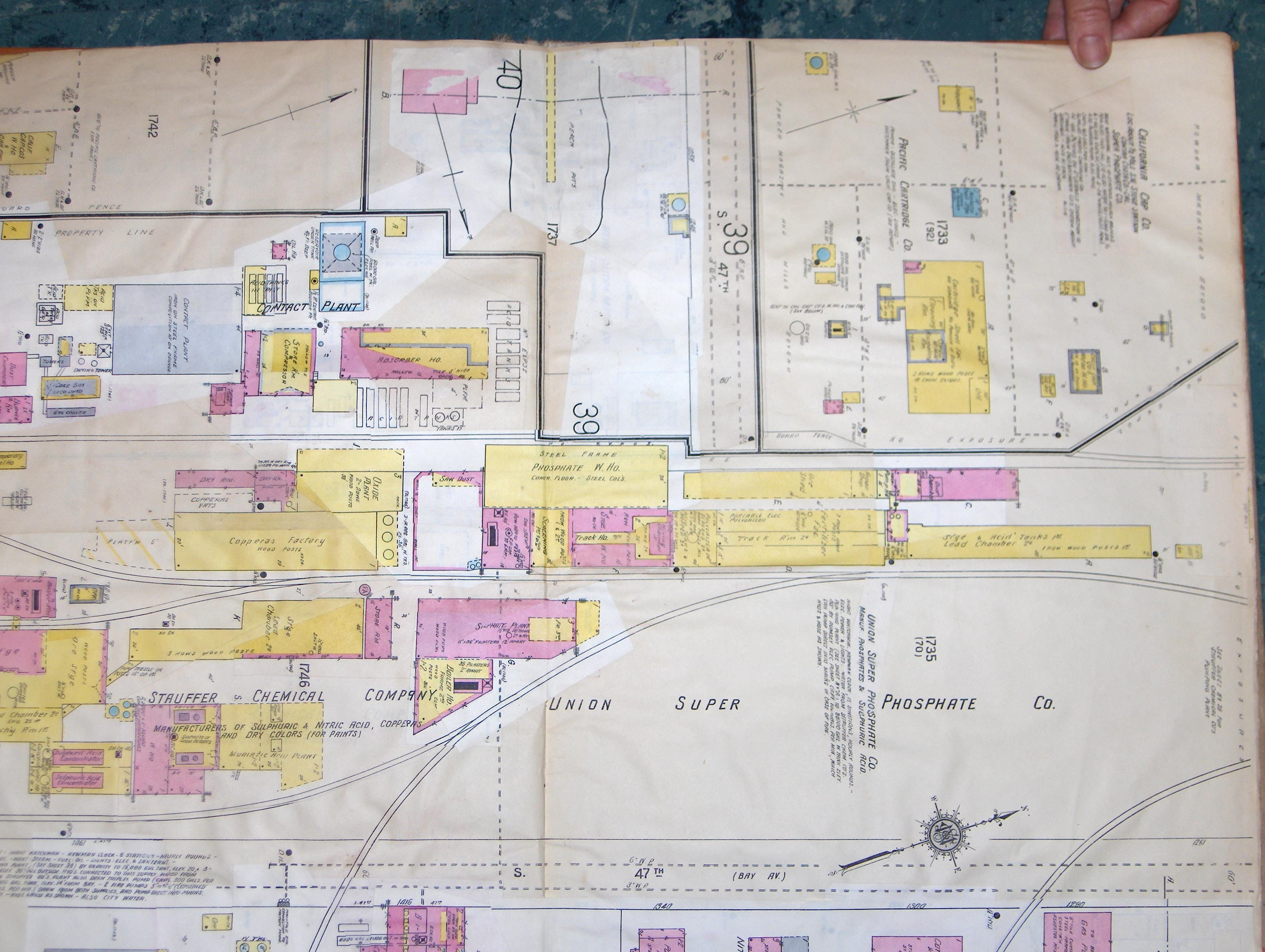
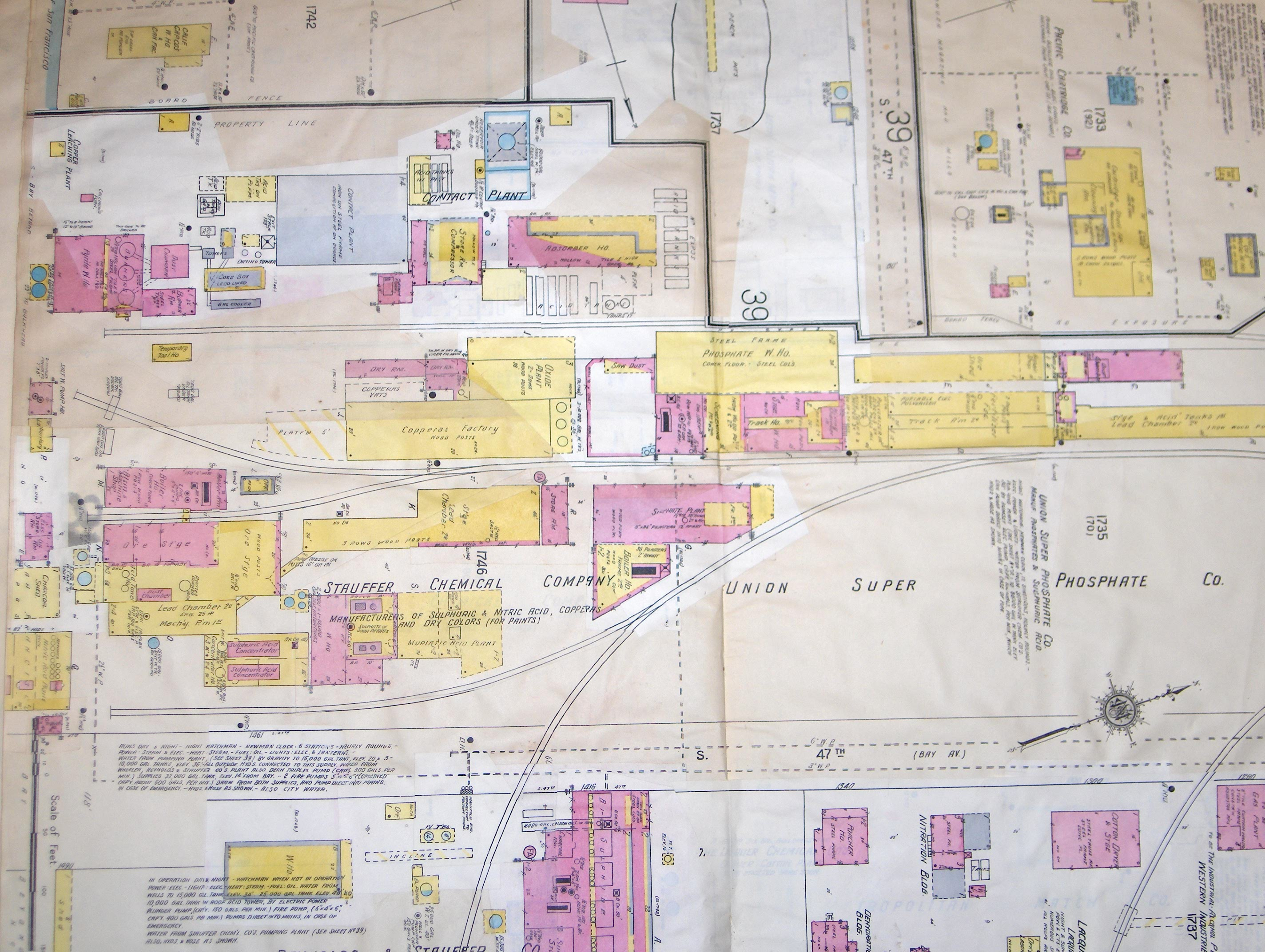
These 1916 Sanborn Insurance Maps visually represent part of the historical continuum, recording the early stages of the toxic manufacturing process on the site. They provide documentation of toxics heretofore not recorded.
[Use your browser's magnifier to zoom in for details.]
- Overall view of the map: zenecaMAPS1916 006.jpg
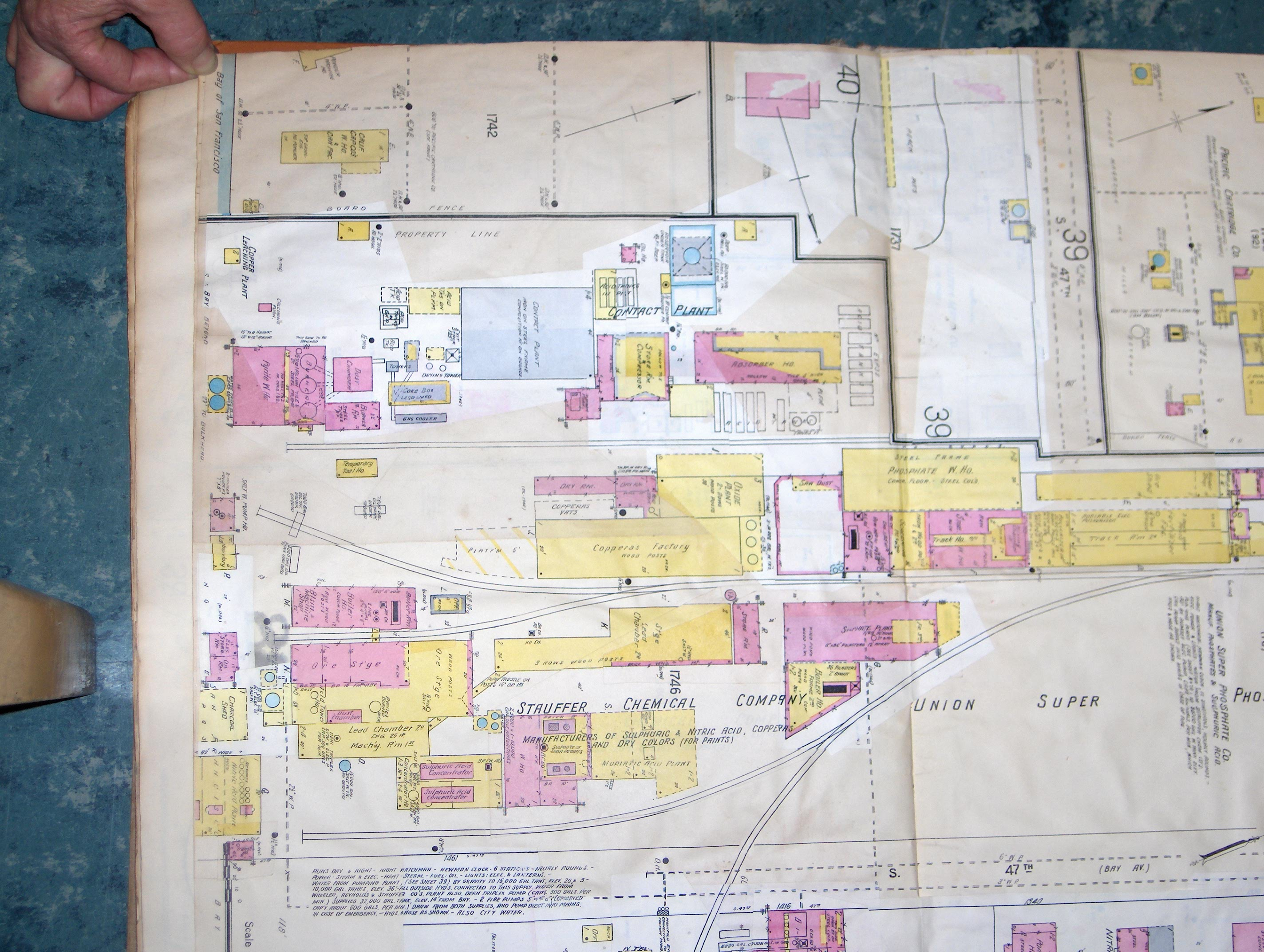
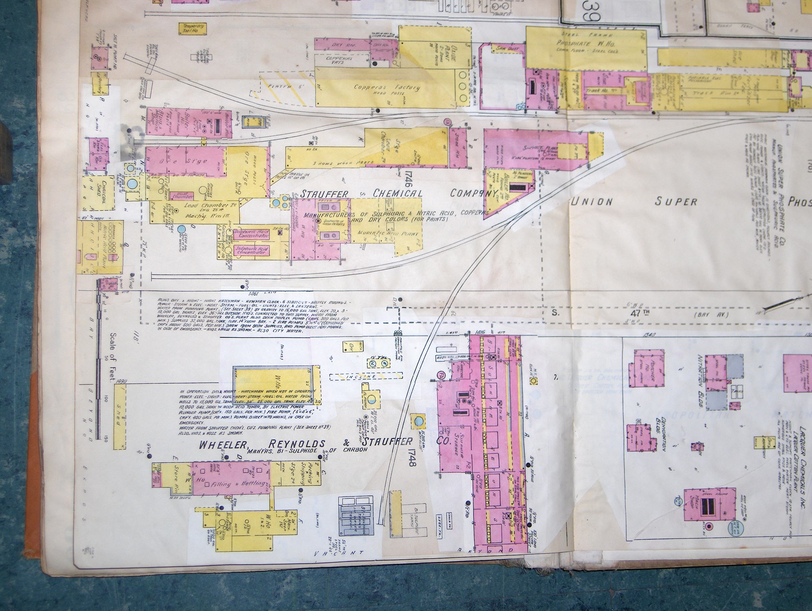
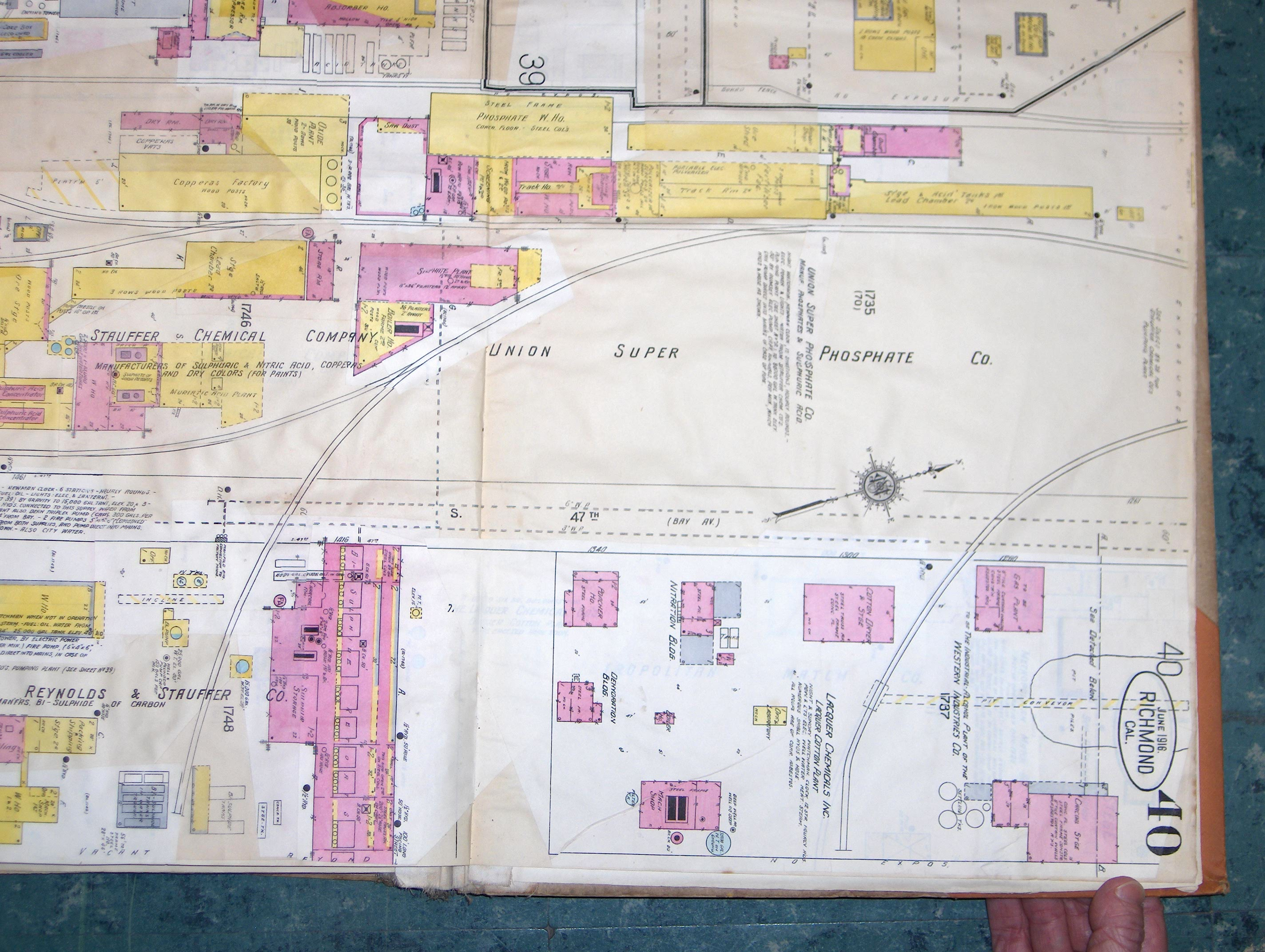
- Below are several shots of the same map, but more close-up. Some may have more readable detail in certain areas than others.